mexico

Route to the Rio: Puerto Aventuras to Bahía de la Ascension, Mexico

Route to the Rio: Puerto Aventuras to Bahía de la Ascension, Mexico

The house we had lived in for almost four years in Playa del Carmen, Mexico was being packed up. The movers and their truck were in and out over several days with multiple trips. It was as hot as it gets in May in the Caribbean.

Simultaneously, work was at its capacity with Katy organizing the entire decor for the handful of weddings her company would be decorating during the month we would be sailing. I was busy running deliveries and working a convention for my beer distribution company and managing all of the day to day of our online marketing company.

For more about our sail along the Mayan Riviera coastline and waypoints you can use for your own sail, read on...

Route to the Rio: Making Plans for Rio Dulce

The channel for our current marina in Puerto Aventuras, Mexico. When we exit this in May, it will be the last time until we return in winter.

The channel for our current marina in Puerto Aventuras, Mexico. When we exit this in May, it will be the last time until we return in winter.

Making Plans

A couple of total amateurs are planning another adventure at sea. After our first real sail from Florida to Mexico, we're getting ready for the next one, late spring 2015.

Mexico to Belize to Rio Dulce, Guatemala

We're aiming to untie the lines on May 22nd, exactly two years after we were married on the beach in Tulum. This would give us a nice 7-10 day window to explore Belize without taking too much time before storm season shows up, arriving in Rio Dulce around June 1st. We'll stay until late November and begin the passage north back to Puerto Aventuras after hurricane season comes to a close.

Goff's Cay, Belize — 17° 21.00'N 88° 02.18'W

Sure, it's about five months away so planning now might seem a bit eager, but with our work schedules, months seem to disappear and dates approach with speed. 

There is some minor boat maintenance, installing a wind generator our friend from H2Oh Sun Cruises donated to us with a new auto-pilot, route planning and navigational studies, patching the dinghy, and your general provisioning closer to the date.

One night while we were out of town, a drunken tourist couple boarded our boat. The guy took the helm, turning the wheel back and forth pretending to steer while the girl hung off our davits (a system on the stern of the boat used to raise and lower your dinghy from the water) jumping up and down on our dinghy, "Woo! Woooo!" 

Good thing our pal Mack was at the marina and came to the rescue. When he told them to get off the boat, the drunken man got a little verbal and aggressive. Mack put him to the ground, forcing him to call for his girl to hurry up and get off the boat. And that was that. We came back to a dingy, deflated in the middle hanging in a "V" shape to the water. So, we now have a deflated dingy with a few little tears in the seams.

SUCH A THING AS Route Planning TOO FAR IN ADVANCE?

We like to know our routes well in advance and have them memorized as well as possible so while underway recognizing the fixes and horizons doesn't feel like new territory. Especially with all of the shoals, rock and coral along Belize.

We draw 4', so it shouldn't be as much of a concern as others have in the region, but there are still some tricky spots along the reef line. For those not sure what a boat's "draw" means, it's your boat's draft — the vertical distance from the water to the bottom of your boat under water.

We have paper charts, Freya Rauscher's charts, Navionics (with MacENC), Garmin's BlueCharts and have been referencing ActiveCaptain. Between the lot of them we should have as good a reference of the area as you can without having been through yet. 

The western Caribbean region here doesn't seem to be consistently documented by any of the chart makers, so we've been taking notes of inconsistencies between each from first-hand accounts of other sailors. One may be right at this anchorage, while another has a reef entry a bit too far east.

When we write our own posts for each anchorage along the way I will account for corrected waypoints in the sidebar and any details. This Route to the Rio series, when complete, should help out anyone else heading along the same path.

Plans for rio dulce

  • Haul the boat for a new bottom paint job.
  • Brightwork from some storm damage against a concrete pier (we lost five fenders to the concrete, and then the teak rail became a fender before we were able to fix the problem).
  • Fresh non-slip topside paint job.
  • Eat, fish, drink. Repeat.
  • Work remotely from the boat.
  • Visit interior Guatemala.

We have a growing list of the cays to stop off at along the way, but any suggestions, waypoints or tips for the route or while in Rio Dulce are welcome in the comments or use the contact page!

Photo of the Rio Dulce from Flickr, by Domingo Leiva.

Photo of the Rio Dulce from Flickr, by Domingo Leiva.

Current Location

Puerto Aventuras, Mexico
20° 29.96'N 87° 13.45'W

Required Reading

To Belize and Mexico's Caribbean Coast

Capt. Freya Rauscher's is the go-to guide covering the region from Mexico's Caribbean coast all the way down to the Rio Dulce. She covers Honduras a bit as well, but that's not on our itinerary, so we'll leave it out of anything we cover.

Click the image above to buy her guide on Amazon.

Active Captain

While the guide book is our main source of well documented information about the different regions, Active Captain works as great supplementary content. Double checking all of the anchorages in Active Captain has already corrected a waypoint error I was wondering about off in Capt. Rauscher's book while entering Banco Chinchorro, which you can see by clicking here.

The Scraps: Photos from Along The Way

Welcome to a pile of random images, in no particular order or fashion, that just never made it into a post anywhere.

They are from our recent crossing. 

Bridges on the Intracoastal Waterway, sunsets along a coast, cats on islands and abandoned forts in the middle of nowhere...

Along the Mayan Riviera

This weekend we spent two days in Puerto Aventuras and along the coast of the Mayan Riviera. This time on our friend's yacht, Piratas de Tejas which runs charters under the name h2oh Sun Cruises. One day full of clouds, the other with sun.

The 72' yacht, Piratas de Tejas of h2oh Sun Cruises.

The 72' yacht, Piratas de Tejas of h2oh Sun Cruises.

Their tours include a pretty amazing list of activities like game fishing, snorkelling with sea turtles and the thousands of reef fish you'll encounter, karaoke at sea, open bar, a boat tour through the beautiful, private marina in Puerto Aventuras and a bunch more.

We'll be writing a bit more about the tours in the near future since we'll be working with them on some projects coming up.

One Lap Around The Bay

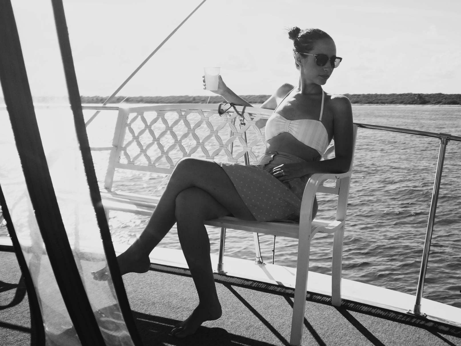
It doesn't look like it in this shot, but at one point out in the Yucatan Channel in front of Puerto Aventuras, we were in 8'-10' seas with short periods and high winds. It was supposed to be a mellow Sunday with our friends Miguel, Susana and their two year old daughter, Uma.

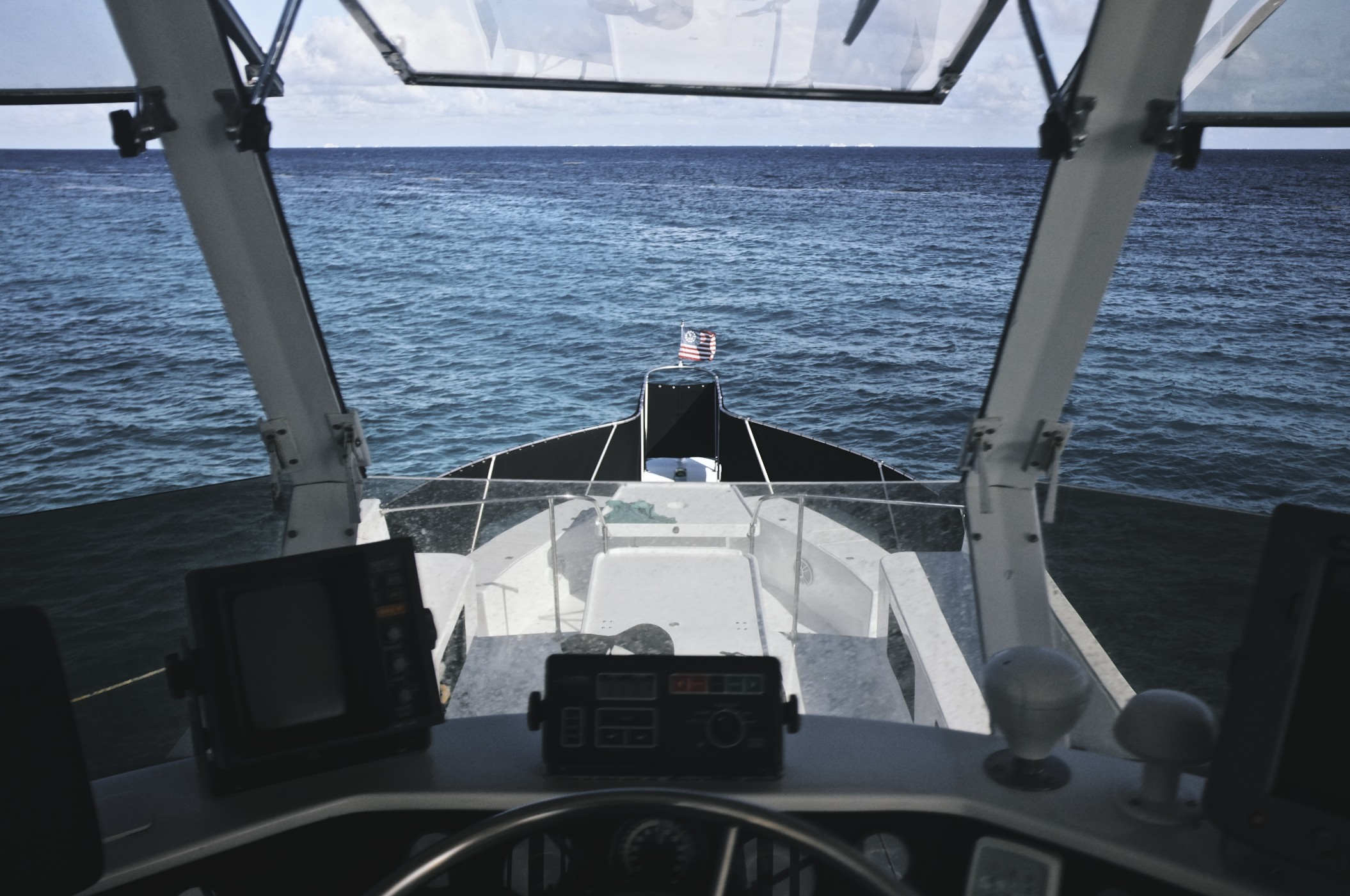
Then the bow of Edward Blair dug into, and submerged through one of the largest waves we were confronted with, breaking out the other side. While all the adults aboard were wondering if the conditions would ease up or not, Uma took a nap. Uma doesn't worry about big waves and poor conditions.

After only an hour at sea on a no-destination Sunday Sail with friends, we grew tired of getting tossed around, making between 1.5 and 4 knots, depending which side of a wave we were on, and headed back to the marina for a better idea. Barbecue and beer.

Sure, it's damned fun to watch as the bow of your boat goes straight into the ocean and comes back up, blowing through the waves in front of you, but with a two year old aboard and a full cockpit with no real destination it was time to avoid the, "This could get worse..." possibilities and head on in. 

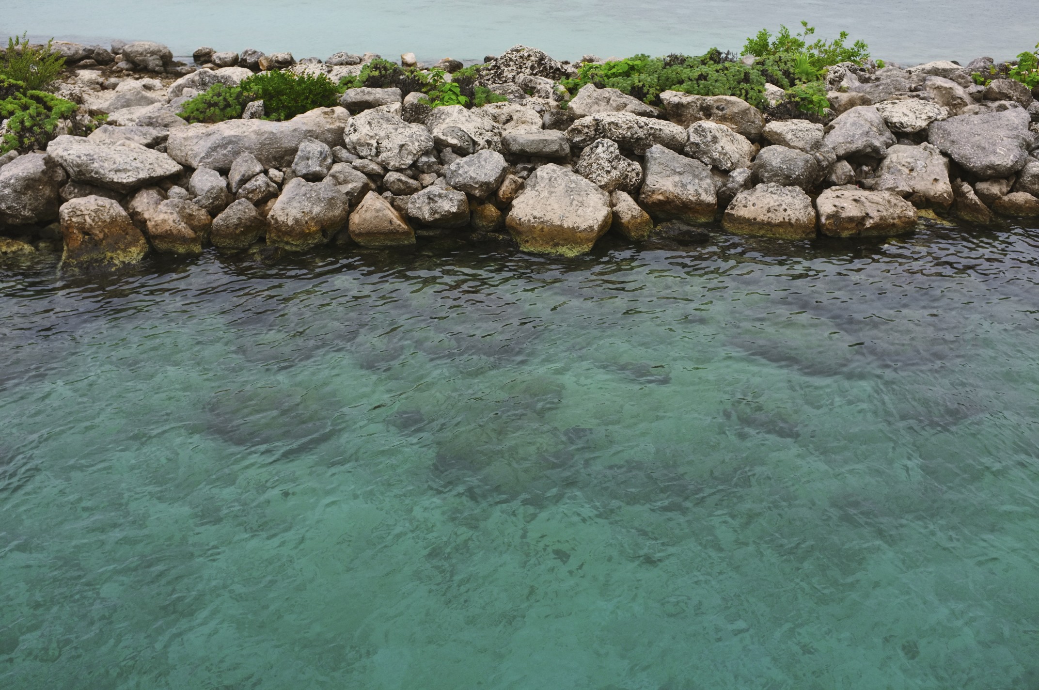
Later in the day around 5pm the winds calmed down and so did the seas. Our friends Mack and Lisa came over to our slip in their 26' zodiac and its 250hp outboard. They picked us up and whipped out across the bay, airing off the tops of the longer, rolling waves into a protected caleta where cenote water comes out from under the seabed.

When the cenote water merges with the ocean water, it makes a cold mix of salt water and fresh water that will redeem the day and cool everyone down in this Caribbean heat.

All photos by our good friend, Susana Hidalgo.